WalkSydney
About
Our Asks
Committee and Constitution
Our partners
Our work
Publications
Campaigns
Submissions
WalkSydney submission to government
Older Submissions
Updates
Articles
Substack newsletter
Get involved
Become a member
Category:
Maps
Advertising
,
Billboard
,
Footpaths and Sidewalks
,
Green Square
,
Kerbs
,
Maps
,
Sydney
,
Technology
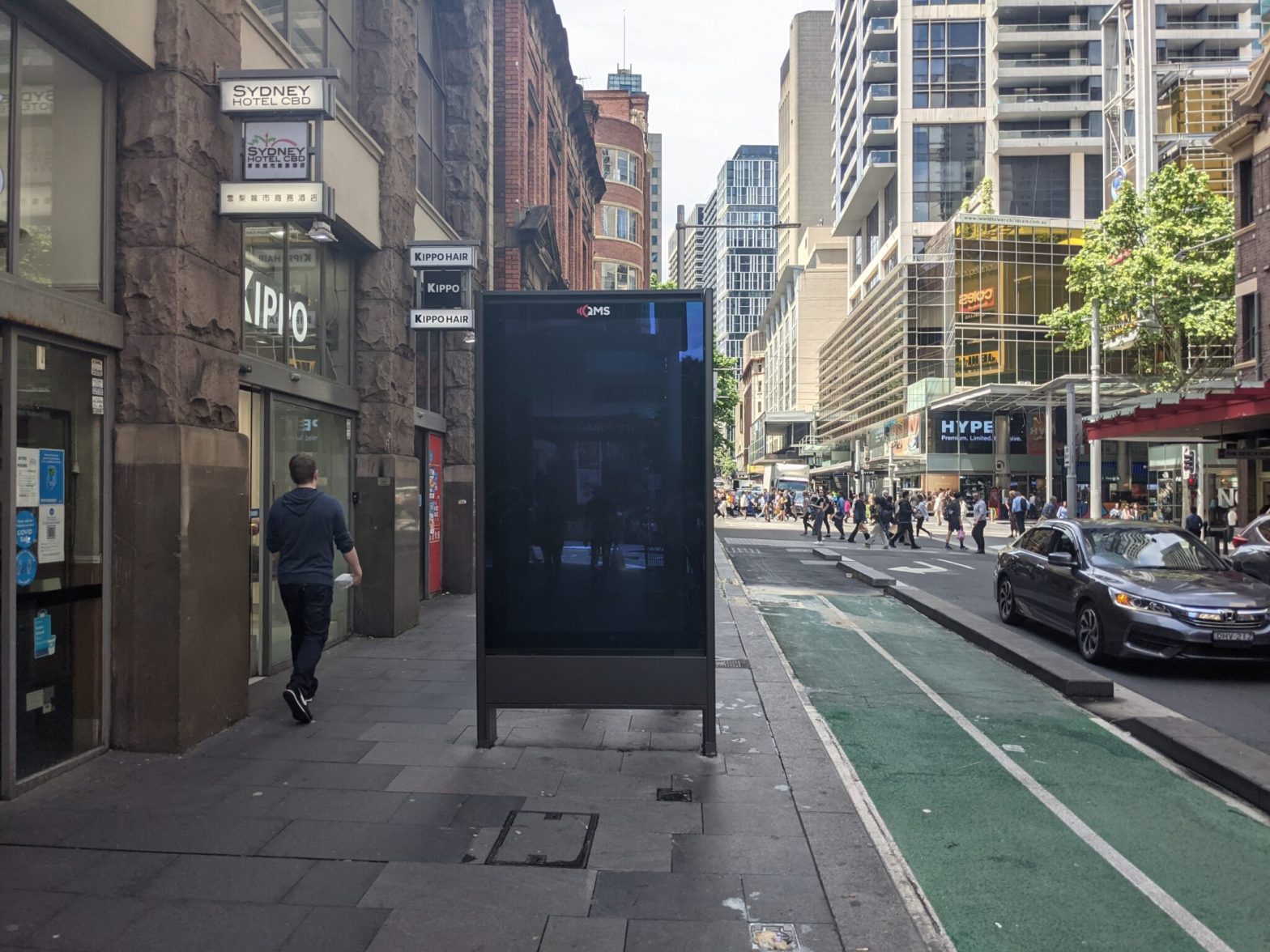
Mapping Sydney Billboards: Every QMS advertising panel in Sydney
Maps
,
Movement and Places
,
Navigation
,
Sydney
,
Technology
Pedestrians left at the kerb by Google Maps
Maps
,
Public Transport
,
Sydney
,
Walks
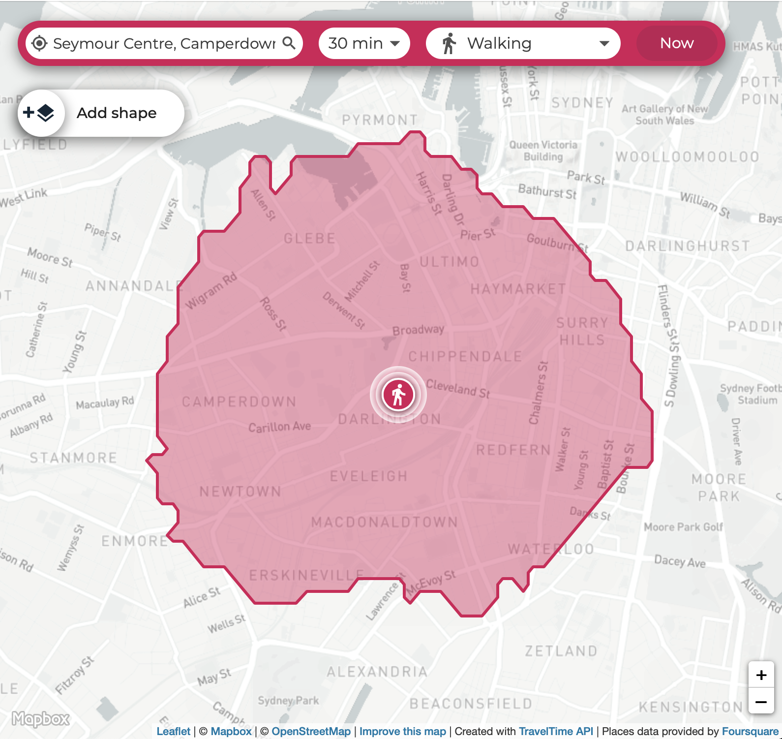
Map Monday: Isochrones and the Thirty-Minute City
Loading Comments...
You must be
logged in
to post a comment.

You must be logged in to post a comment.